, formerly the NOAA National Geophysical Data Center (NGDC)")
|

|
Core Data from the Deep Sea Drilling Project
DSDP holes in the Norwegian Sea
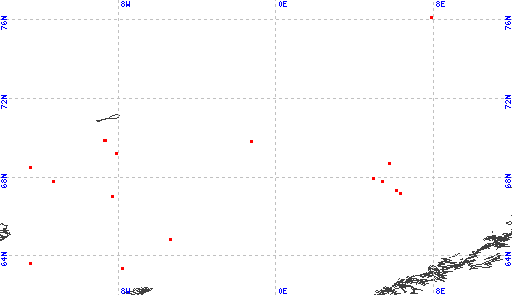
Red dots represent sites. Overprinted locations include links to adjacent sites.
hole leg latitude longitude 336 38 63.3510 -7.7878 337 38 64.8717 -5.3418 350 38 67.0557 -8.2947 340 38 67.2078 6.3063 339 38 67.2108 6.3175 341 38 67.3350 6.1107 338 38 67.7852 5.3877 351 38 67.7890 -11.3043 342 38 67.9507 4.9337 348 38 68.5030 -12.4620 343 38 68.7152 5.7622 349 38 69.2068 -8.0967 345 38 69.8372 -1.2377 347 38 69.8718 -8.6967 346 38 69.8892 -8.6855 |
|
Cite as: Deep Sea Drilling Project (1989): Archive of Core and Site/Hole Data and Photographs from the Deep Sea Drilling Project (DSDP). National Geophysical Data Center, NOAA. doi:10.7289/V54M92G2 [access date]
Please see NOAA's privacy and disclaimer information. Send questions or comments to mgg.info@noaa.gov.
|