, formerly the NOAA National Geophysical Data Center (NGDC)")
|

|
Core Data from the Deep Sea Drilling Project
DSDP holes in the Red Sea
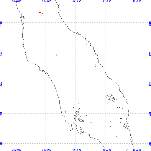
Red dots represent sites. Overprinted locations include links to adjacent sites.
hole leg latitude longitude 229 23 14.7682 42.1912 229A 23 14.7682 42.1912 230 23 15.3167 41.8342 228 23 19.0860 39.0033 225 23 21.3097 38.2518 227 23 21.3310 38.1328 226 23 21.3418 38.0822 226A 23 21.3418 38.0822 226B 23 21.3418 38.0822 226C 23 21.3418 38.0822 |
|
Cite as: Deep Sea Drilling Project (1989): Archive of Core and Site/Hole Data and Photographs from the Deep Sea Drilling Project (DSDP). National Geophysical Data Center, NOAA. doi:10.7289/V54M92G2 [access date]
Please see NOAA's privacy and disclaimer information. Send questions or comments to mgg.info@noaa.gov.
|