Marine Seismic Reflection
United States Geological Survey
|
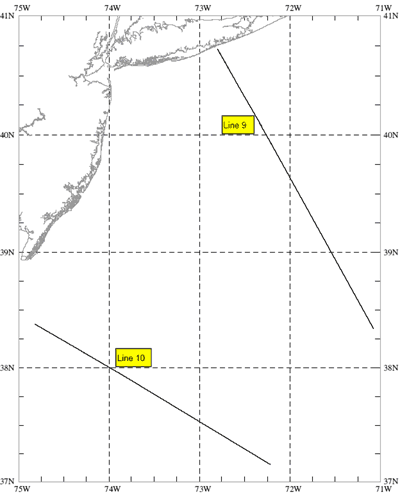
As part of a program by the U.S. Geological Survey (USGS) to gain a better understanding of the general geologic framework of the Continental Shelf, Slope, and Rise and its relationship to onshore geology and to help assess the petroleum potential of the Continental Margin, a number of multichannel common depth point (CDP) seismic reflection lines have been collected from the Atlantic. The National Geophysical Data Center of NOAA will serve as the agency to make these data available for general use as they are released by the USGS. This is to announce the availability of the digital data and seismics sections for survey lines 9-10 on the Northeastern Atlantic coast.
This data set includes both scaled sections and true amplitude sections in half scale (1.25 in./sec) and full scale (2.5 in./sec). Please note that only the full scale sections have been scanned with images available online. Velocity profiles are available on microfilm (reel 733).
These data were collected aboard the Gulf Seal from October 2, 1975 to November 21, 1975.

